
The $76 billion company is taking its geographic information systems mobile, helping employees answer questions in near real time.
Geographic information systems aren’t exactly new. Drugstore chain Walgreens has used the technology for close to 15 years for market planning.
More recently, however, the company has endowed that visual information with location-specific data—and published far more broadly, so that store managers and its corporate real estate team can use it for planning.
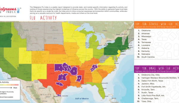
The system, called WalMap, can be used to visualize local community trends. A spike in flu medication prescriptions could help store managers decide earlier to order more vaccine, preventing shortages. Walgreens sales executives can reference trends in supplier conversations. Plus, the interactive maps can be used by the corporate planning team to determine the best place for a new store, based on community demographics, competitor information, and sales trend information. They can even be viewed on an iPad.
“Ten years, our teams had to print out a map and take it with them. Now they can bring their mobile device, and have access to updated sales, demographics and other targeted information,” said Jillian Elder, director of enterprise location intelligence for Walgreens.
For complete article on Fortune.com, click here.
